We crossed the incredibly high Astoria-Megler Bridge that stretches over four miles across the Columbia River from Astoria to Point Allice Washington. The bridges main truss is the longest continuous truss in the US. The area boasts super high tides that uncover huge mudflats at mean low tide uncovering a multitude of tasty razor clams.
The Astoria-Megler Bridge
We worked our way to Olympic National Forest and stopped at Ruby Beach to get a view. Desolation Island sits off the coast. The area is incredibly beautiful yet quite harsh. The name Desolation Island fits the area perfectly. It is a place to get away from it all.
 |
| Desolation Island |
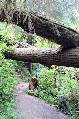
We continued on to the Hoh Rainforest and hiked through a trail leading to the Mossy Maple Grove. It's amazing to see the rich life cycle that exists in the shady, wet environment. We wish we had more time to explore Olympic National Forest.
Hoh Rain Forest
Rain Forest Creek Video
We attempted a drive out to Cape Flattery, the western most point in the continental United States. The roads were marginal, even washed out in spots. We made it to the entrance of the Makah Indian Reservation at Neah Bay and were stopped. Signs indicated no further travel was allowed due to Covid. Disappointed, we made the long, slow trek back and arrived in Port Angeles around 7:00 pm.
 |
| Cape Flattery Map by Wave Run 500 |
 |
| Neah Bay map by Alltrails |
Our hotel was on a hill above downtown Port Angeles. We took an early morning walk to explore finding a waterfront park, shops and restaurants as well as gorgeous views of Mount Olympic. The tide runs high at 13-14 feet. It was very quiet in Port Angeles. It seemed like the town was still a bit shut down from covid. We met a local gal who told us the ferry to Victoria, BC had been closed for a year causing tourist traffic to decrease tremendously.
 |
| Steps to downtown Port Angeles |
 |
| Mural Art |
 |
| Mount Olympic |
 |
| Port Angeles Wharf |
 |
| Waterfront Park Art |
 |
| Octopus in the park |
 |
| Super low tide |
 |
| Barge traffic between the US and Canada |
 |
| Mount Olympic |
 |
| Low tide showing off high tide line |
The most direct route from Bremerton to Eugene Oregon is over the Hood Floating Bridge. It sits on concrete pontoons divided into sections and is the longest floating bridge in the world. The floating section is 1.2 miles long. In 1993, sustained winds of 80 mph, gusting to 120 mph with 15 foot seas sunk the bridge. It is in constant need of repair. We had to wait about a half hour to cross due to road work but the wait dramatically shortened our drive.
 |
| Hood floating bridge traffic |
We left Washington behind and headed for Columbia Gorge and Multnomah Falls. Our internet search indicated we would not be able to park at the falls but that proved to be untrue. The falls are visible right from the highway. To get close up, we had to walk under the highway, then take a path up to a viewing station where the mist of the falls reached us. We climbed up 866 feet to the top on a 1.25 mile trail that was only about 3 feet wide. The inside of the trail was mountain, the outside a drop off. I had to keep my eyes on my feet and the trail. At the top, we walked down to a viewing platform that was at the very top of the falls. The sound and sight of rushing water was confusing and unsettling but it also gave us a rush of excitement. It took us a good hour to go up and only 20 min to come down. Our legs were rubber at the bottom!
 |
| View from the parking lot |
 |
| Water cascading down |
 |
| View on the way up |
 |
| View on the way up |
 |
| Dave making his way UP |
 |
| Just above the top of the falls |
 |
| View at the very top |
 |
| Which way? Lot's of trails to choose from |
 |
| Following single file down |
 |
| Our red Expedition is in the middle |
Falls View from the bottom Video
View from the top of the Falls "Oh my God" video
We had to get back to Reno by Friday the 15th. We chose the gorgeous Willimette River Scenic Byway to get there. We stumbled upon the beautiful Lowell Covered Bridge just above the dam. We met a man from Minnesota who retired in Lowell. He said it is a wonderful place to live! We have to agree, it was very peaceful!
 |
| Poppies growing wild along the dam |
 |
| Willemette Dam |
The Willemette River is rugged and fed by a lot of water rushing down off the mountains. We passed O'Dell Lake where there are a ton of fishing boats. It's near Willamette Pass, one of several lakes in the Cascade Range in Central Oregon. It's full of bull trout, mountain whitefish, rainbow trout, lake trout and sockeye salmon.
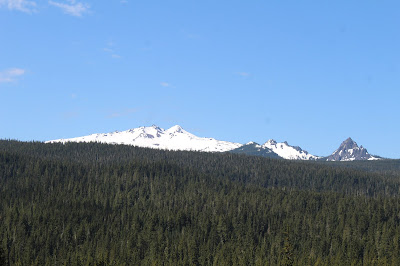
We enjoyed beautiful views of Diamond Peak Volcano along the highway. We were surprised to see a lot of garbage alongside the roads coming off the pass. The Collier River section had a huge wildfire area just before Chiloquin and Klamath Lake. We drove through a town named "Madeline", my legal first name. The population is 60! We wanted to stop at Crater Lake but we ran out of time! What we learned on our trip was that you need a lot of time to thoroughly experience this area of America. We hope to get back one day.
We'll head home to Minnesota in the morning. We are excited to get back to our lives! We plan to spend a couple weeks at home, settling affairs and packing up our boat gear. We will head back to our America's Great Loop adventure in June! S/V Mystic is waiting for us at Frank Hall Marina in Avondale, Rhode Island. It's time to get back to the water.


No comments:
Post a Comment